Landslide Technology
  • Home
  • Specialty Services
    • Geotech. Asset Mgmt. >
      • Montana Rock Slope Asset Mgmt. Program (RAMP)
      • Alaska Geotech Asset Mgmt
      • Ohio Landslide Inventory
    • Rope Access
    • 3D Modeling
    • Dam Safety & Slope Stability
    • Const. Sequence Modeling
    • Geotechnical Instrumentation
    • Construction Engineering
    • Expert Witness
  • Landslides
    • Hydropower >
      • Bull Run Flume
      • Swift Powerhouse
      • Frog Lake Dam Slide
    • Transportation >
      • Hwy 101 Johnson Creek
      • Looking Glass Hill Slides
      • SR 87 Arizona Slide
      • Togwotee Pass Road
      • Scoby Hill Landslide
      • Wrangell Airport
      • Snowbasin Access Road
      • Beartooth Debris Flows
      • Three Capes Scenic Loop Landslide
      • Richardson Hwy Slide
      • Bonners Ferry Landslide
      • Light Rail Station
      • Skagway Submarine Slide
    • Natural Resources >
      • West Africa Gas Pipeline
      • Greens Creek Mine Road
    • Private Clients >
      • Wasco County Landfill Landslide
  • Rock Slopes
    • Hydropower >
      • Biscuit Rock Rockslide
      • Skagit River Rockfall
      • JC Boyle Canal Rockfall
      • Prospect Dam Rockfall
      • Iron Gate Dam Rockfall
      • Cougar Dam Rockfall
    • Transportation >
      • I-15 (D3) Rock Slope Mitigation
      • Ketchikan Third Avenue
      • US Hwy 2 Libby Rockfall
      • Banks - Lowman Hwy
      • SR 191 Rock Cut Design
      • Going-to-the-Sun Road
      • SR 12 Rockfall Mitigation
      • Lakeside Rockfall
      • US 2 Badrock Canyon
      • South Tongass Highway
      • Weeksville Rock Bolting
      • US 26 Cove Palisades
  • Key Staff
    • Mike Meyer
    • Gerry Heslin
    • George Machan
    • Charlie Hammond
    • Brent Black
    • Darren Beckstrand
    • Chris Carpenter
    • Ben George
    • Wade Osborne
    • Tom Westover
    • Aine Mines
    • Adam Koslofsky
    • Logan Allender
    • Andy Kost
    • Collin McCormick
    • Anna Casady
    • Noah Kimmes
    • David LaPorte
    • Justin McCarley
    • Aleyna Donaldson
    • Michael Bunn
    • Andy Vessely
    • Larry Pierson
    • Derek Cornforth (Founder)
  • Resources
  • Contact Us

Ohio Landslide Inventory and Asset Management

Statewide, Ohio
Evaluating a landslide in Ohio
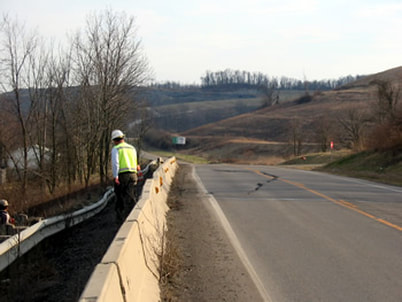
Conducting a Landslide/Asset Management Inventory
The Ohio Department of Transportation (ODOT) selected Landslide Technology (LT) to assist them in developing a Landslide Hazard Rating Matrix (Ohio LHRM) as a tool to manage landslide hazards along ODOT highways. The Ohio LHRM provides a relative ranking of sites for landslide hazard and vulnerability, which ODOT utilizes as a tool for prioritizing capital expenditures for mitigation. Each slope that is evaluated has a unique numerical rating accounting for failure/movement classification and causation, geologic and groundwater conditions, roadway construction methods and material properties, impacts of failures on roadways and traffic (i.e. detours, out of direction costs, etc.), failure and maintenance frequency, annual maintenance data and costs, remediation concepts and estimated costs, and public safety.
​
The Ohio LHRM system was developed by LT in a phased approach in conjunction with the University of Ohio at Akron. During the initial phase, LT conducted reconnaissance investigations of approximately 44 landslides that were identified as representative failures from each of the ODOT Districts. Data gathered from the landslides were statistically analyzed to provide a basis for developing a rating system for the state as a whole. LT then developed rating criteria, assigned scoring and weighting values, and prepared field data collection forms that were tailored for ODOT and the geologic conditions that are encountered throughout their Districts.


Proudly powered by Weebly
  • Home
  • Specialty Services
    • Geotech. Asset Mgmt. >
      • Montana Rock Slope Asset Mgmt. Program (RAMP)
      • Alaska Geotech Asset Mgmt
      • Ohio Landslide Inventory
    • Rope Access
    • 3D Modeling
    • Dam Safety & Slope Stability
    • Const. Sequence Modeling
    • Geotechnical Instrumentation
    • Construction Engineering
    • Expert Witness
  • Landslides
    • Hydropower >
      • Bull Run Flume
      • Swift Powerhouse
      • Frog Lake Dam Slide
    • Transportation >
      • Hwy 101 Johnson Creek
      • Looking Glass Hill Slides
      • SR 87 Arizona Slide
      • Togwotee Pass Road
      • Scoby Hill Landslide
      • Wrangell Airport
      • Snowbasin Access Road
      • Beartooth Debris Flows
      • Three Capes Scenic Loop Landslide
      • Richardson Hwy Slide
      • Bonners Ferry Landslide
      • Light Rail Station
      • Skagway Submarine Slide
    • Natural Resources >
      • West Africa Gas Pipeline
      • Greens Creek Mine Road
    • Private Clients >
      • Wasco County Landfill Landslide
  • Rock Slopes
    • Hydropower >
      • Biscuit Rock Rockslide
      • Skagit River Rockfall
      • JC Boyle Canal Rockfall
      • Prospect Dam Rockfall
      • Iron Gate Dam Rockfall
      • Cougar Dam Rockfall
    • Transportation >
      • I-15 (D3) Rock Slope Mitigation
      • Ketchikan Third Avenue
      • US Hwy 2 Libby Rockfall
      • Banks - Lowman Hwy
      • SR 191 Rock Cut Design
      • Going-to-the-Sun Road
      • SR 12 Rockfall Mitigation
      • Lakeside Rockfall
      • US 2 Badrock Canyon
      • South Tongass Highway
      • Weeksville Rock Bolting
      • US 26 Cove Palisades
  • Key Staff
    • Mike Meyer
    • Gerry Heslin
    • George Machan
    • Charlie Hammond
    • Brent Black
    • Darren Beckstrand
    • Chris Carpenter
    • Ben George
    • Wade Osborne
    • Tom Westover
    • Aine Mines
    • Adam Koslofsky
    • Logan Allender
    • Andy Kost
    • Collin McCormick
    • Anna Casady
    • Noah Kimmes
    • David LaPorte
    • Justin McCarley
    • Aleyna Donaldson
    • Michael Bunn
    • Andy Vessely
    • Larry Pierson
    • Derek Cornforth (Founder)
  • Resources
  • Contact Us