Iron Gate Dam Access Road Rockfall Mitigation
Hornbrook, California
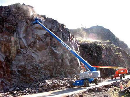 Scaling and Bolting Activities
ate Dam is located on the Klamath River system in northern California. An approximately 2,000-foot long road provides access to a powerhouse and fish nursery at the base of the Dam. The access road paralleled a 200-foot tall rock slope with an active history of rockfall that presented a substantial risk to the powerhouse, fisheries personnel, and visitors.
Landslide Technology (LT) was retained by PacifiCorp to perform an evaluation and develop rockfall mitigation options. A modified version of the Rockfall Hazard Rating System (RHRS) was used to determine which slope sections presented the highest rockfall hazard. Following the RHRS evaluation, multiple mitigation measures including extensive scaling, draped gabion mesh, shotcrete, ditch improvements, and key block rock bolting were implemented to improve site safety.
Due to the concern for worker safety, PacifiCorp chose to mitigate the entire slope rather than individual high rated sections. During construction, LT provided full time on-site QA/QC construction observation services.
Services Provided:
|
|