Geotechnical Asset Management Programs
|
Landslide Technology has teamed with state transportation departments in pioneering the field of Geotechnical Asset Management (GAM). This new approach applies the principles of asset management to geotechnical features such as embankments, landslides, rock slopes, and retaining walls. This is performed by inventorying assets, evaluating their condition, and assessing the risks associated with deteriorating conditions. The program benefits agencies by quantifying deterioration rates and life cycle costs for their assets, and features trade-off analyses to prioritize preservation projects. The GAM system helps transportation planners / project managers develop a strong command of the value of their geotechnical assets along with reliable controls for the timing of their maintenance and replacement efforts.
Our work in developing GAM and Unstable Slope Management Programs for the State DOT's of Alaska, Montana, Idaho, Federal Highway Administration, and Federal Land Management Agencies make LT uniquely qualified to develop and implement geotechnical asset management programs. LT has developed expertise in being able to build from existing inventory and assessment programs, such as the Rockfall Hazard Rating System, in order to capitalize on those well tested and understood systems. |
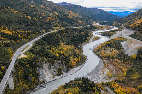
Geotechnical features in a dynamic landscape make the corridor function as intended, including bridge foundations, stabilized landslides, embankments, retaining walls, and rock cuts.
|
Representative Projects:
The programs we have developed adhere to federal guidance in both MAP-21 and the FAST Act and help identify network vulnerability/resiliency programs for not only municipalities and states, but also for owners of railroad, natural gas, pipeline, hydropower, and transmission line assets.
Services Offered for Geotechnical Asset Management:
We have consulted regarding the following aspects as part of our GAM programs and related projects, with projects linked in the top menu:
- Review of existing organizational policy, goals, and objectives to guide a GAM program
- Development of geotechnical Performance Measures, taking into account various performance expectations and risk tolerance
- Inventory and condition assessment program development, training, and implementation using basic forms or advanced field GIS devices and tools
- Development of geotechnical maintenance and event recording tools to better track impacts of adverse events
- Configuration of cloud-based geostatial tools to track an organization's inventory and condition assessments and communication of network risks, often using preexisting IT licenses for commercial cloud software
- Valuation of existing geotechnical asset inventories and programmatic cost estimation of funds required to maintain current network condition